Pittville maps
Anyone using the Pittville History Works can now access the Pittville section of the Cheltenham section of the Old Town Survey (1855-7).1
There are several ways in which the maps can be used.
1) The map itself. The original map sections are part of the set of 98 sections which make up the full Old Town Survey of Cheltenham. We are just using twelve at present. The original maps were created as a large-scale water and sewer plan of Cheltenham, but the amount of detail makes them a fascinating record of the streets, houses, and other features of Cheltenham in the 1850s. The image below shows Wellington Road at the southernmost point of Pittville Park gardens. Click here to see what the area including Pittville Gates looks like on the Pittville History Works website.
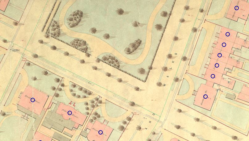
The blue dots are houses we’ve entered on the database. If you hover over any of these you can read a bit about the house (see an example below):
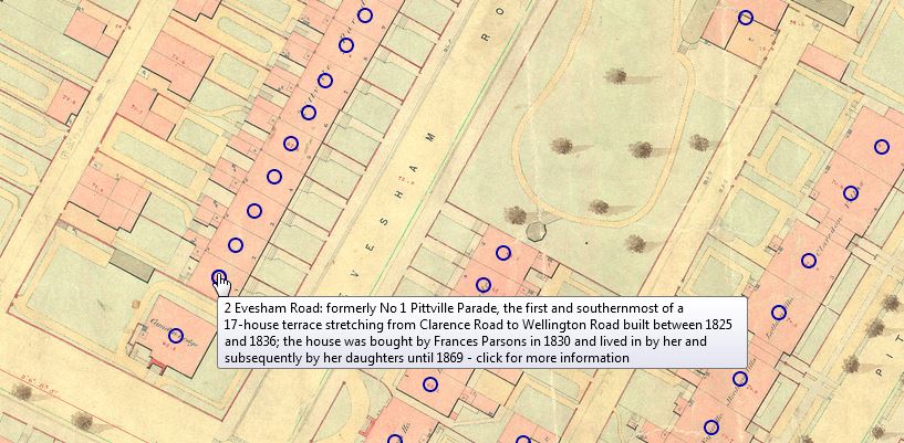
We have those mouseovers for all of the houses we’ve so far added to the database. In future we will be adding mouseovers to other features, such as the Gates. [NB mouseovers don’t work on tablets, which don’t support this feature.]
You can go to a page that shows all nine maps "stitched together" (click where you see "view map selector page").
2) If you want to find out where a particular house is located, find it via the Popular Searches page – for example select this:
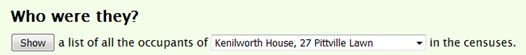
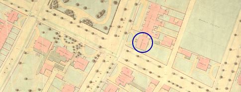
If you click "Show" you are linked through to the house page (in this case, Kenilworth House on Pittville Lawn). Then if you click the map icon (![]() ) you are taken to the map, with the location of the house encircled (http://pittvillehistory.org.uk/showmaps-pop.php?ids=29&width=900). And then you can hover over it, or click the circle for the house page…
) you are taken to the map, with the location of the house encircled (http://pittvillehistory.org.uk/showmaps-pop.php?ids=29&width=900). And then you can hover over it, or click the circle for the house page…
3) This is a powerful feature. If you run any search (on the Popular Searches or Advanced Search) you can see the location of your results plotted on the map. This can be useful in comparing patterns over decades.
An example – military families… Here are the houses containing soldiers (or old soldiers) in 1851, and next to it the equivalent map for 1901 – showing that Pittville Lawn itself is slightly less military (and naval) than it used to be…:
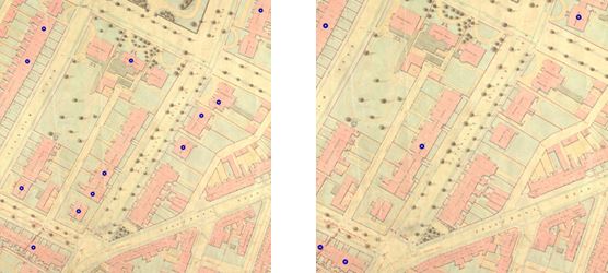
Col. Manners is responsible for the 1901 dot on the Holst Museum (in 1851 the dot is on No 3 – Augustus Hailes RN).
See also the Lloyd George Survey of Land Values: Gloucestershire, published online by the Bristol and Gloucestershire Archaeological Society. The survey maps derive from the "People's Budget" of Gloucestershire, dating from 1909. A map section relating to Pittville can be seen here.
John Simpson
1 The map extracts are reproduced from the CD-ROM of the Cheltenham Old Town Survey 1855-57, published by the Cheltenham Local History Society, and are used with the Society's permission: (c) Cheltenham Local History Society (http://www.cheltlocalhist.